OLD TOWNS BOOKS & MAPS
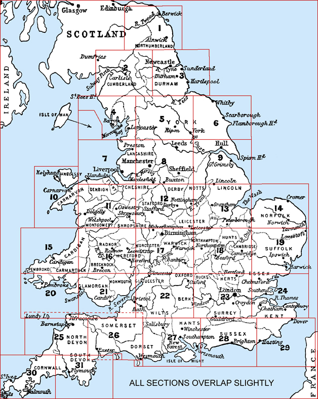
Old Maps of England & Wales in 1900
Essentials for Local Historians, Genealogists & Family Historians
BACK TO MAPS HOMEPAGE >
AVAILABLE AS INSTANT DOWNLOADS
DETAILS:
A snapshot of England and Wales at the beginning of the 20th century, just before The Great War (World War I)
These maps show the towns and villages linked by the road, and the railways with their stations clearly shown.
SCALE: 4 inches to the mile
Source: Barthlomews Royal Atlas of England & Wales, 1900INSTANT DOWNLOADS:
Full size 400dpi format.
Instant secure download at purchase.
View in Adobe Reader or similar software.
Zoom in for amazing detail.CLICK THE PANELS ON THE KEYMAP (BELOW) TO VIEW INDIVIDUAL MAPS: