| HOME | BOOKS | PRINTED MAPS | MAPS ON CD-ROM | GENEALOGISTS | CONTACT US | PRIVACY
Welcome to Old Maps of Kent Collection
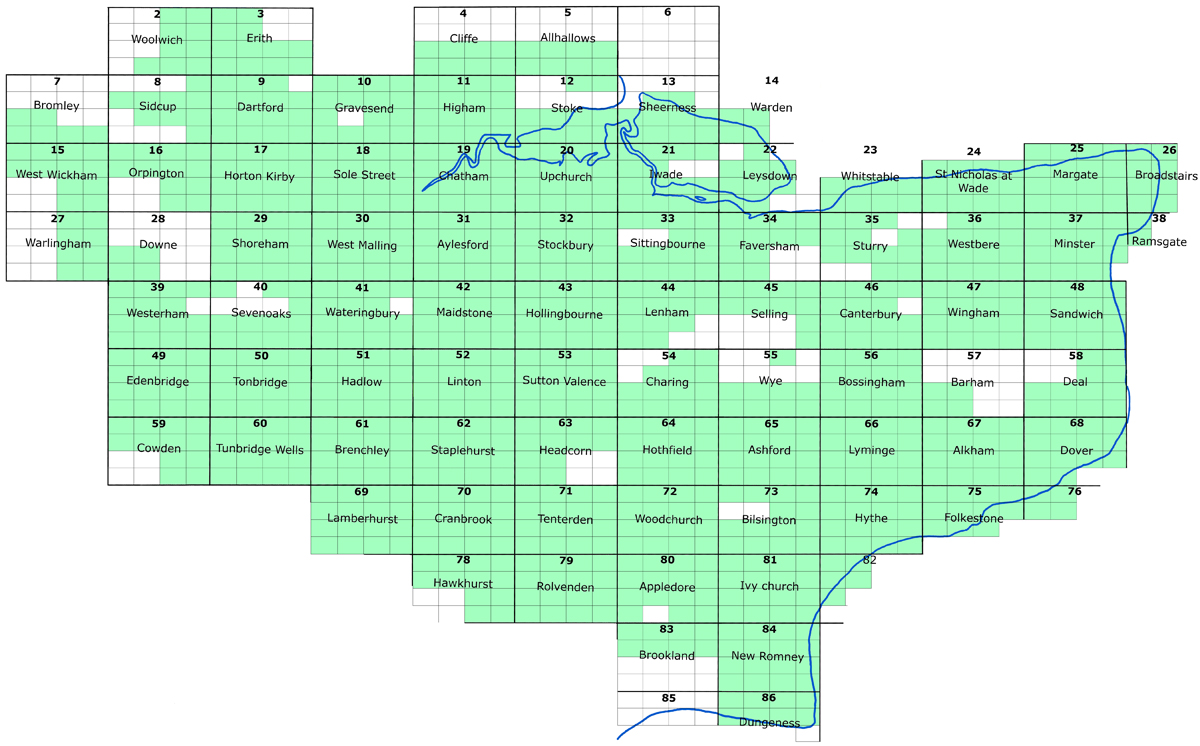
Here you will find old Ordnance Survey maps of nearly all Kent towns and villages by clicking the KEYMAP (below).
All the maps are available as either :INSTANT DOWNLOAD*
A2 SIZE PRINT
A1 SIZE PRINTThese maps are used by genealogists, their highly detailed nature being ideally suited to family history research.
They are invaluable for local history and archaeological research purposes.
* These are high quality Adobe pdf files, available for instant download 24 hours a day.
Please note, these are complete maps, NOT A3 SECTIONS as provided elsewhere.
They are printable to A2 size and larger, or smaller sections are easily printed using the Adobe Reader printing tools.
Remember to zoom to 100% for optimum viewing.If you are familiar with Kent, select an area to view by clicking the keymap below: (hold cursor over names for more details)
or CLICK HERE if you are not sure of the exact location.