OLD TOWNS BOOKS & MAPS
Download Street View Maps of UK Towns
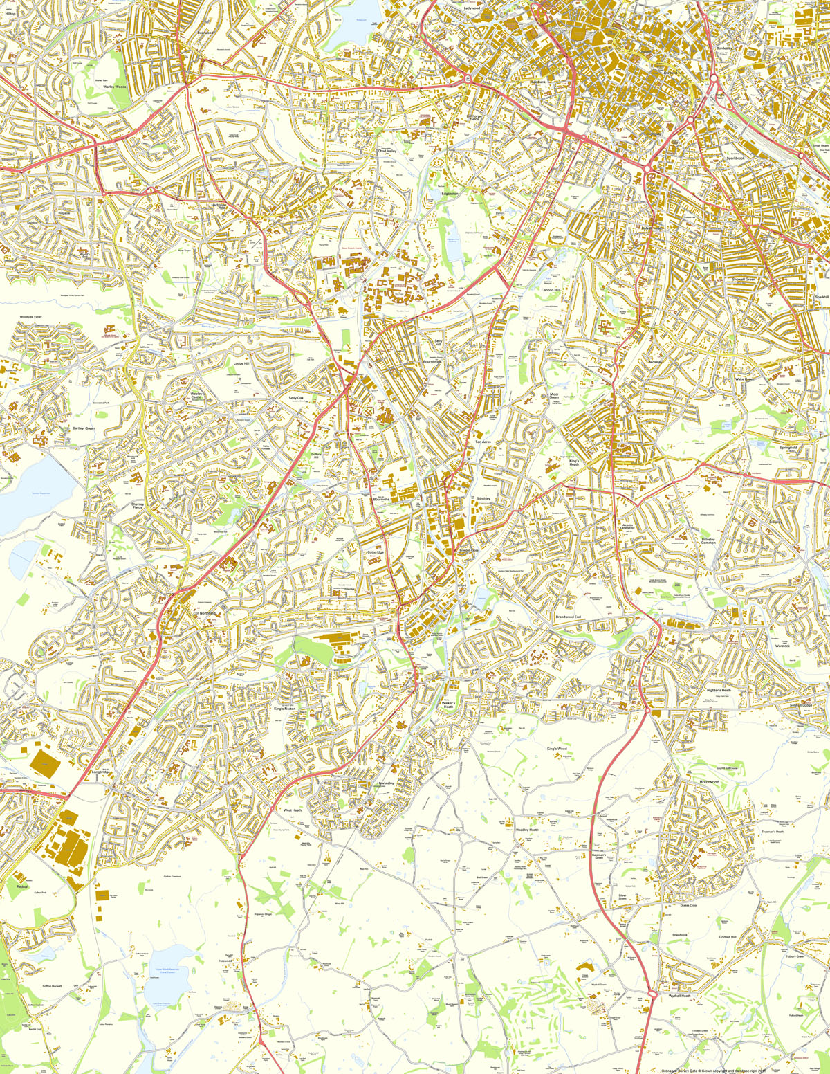
BIRMINGHAM (SOUTHWEST)
SHOWING: Warley Woods, Bearwood, Ladywood (south), Calthorpe Fields, Lee Bank, Digbeth, Deritend, Highgate, Bordesley, Spring Vale, Small Heath (west), Sparkbrook, Balsall Heath, Edgbaston, Chad Valley, Harborne, World's End, Ridgacre, Quinton, Woodgate Valley, Weoley Castle, Lodge Hill, Selly Oak, Selly Hill, Bournbrook, Moor Green, Cannon Hill, Moseley, Wake Green, Showell Green, Sparkhill (west), Springfield, Billesley, Billesley Common, Alcester Lane's End, King's Heath, Stirchley, Ten Acres, Breedon Cross, Cotteridge, Bournville, Griffin's Hill, Shenley Fields, Bartley Green, Northfield, Brandwood End, Warstock, Highter's Heath, Solihull Lodge, Hollywood, King's Wood, Headley Heath, Walker's Heath, Hawksley, West Heath, King's Norton, Turves Green, Longbridge, Hopwood, Trueman's Heath, Grimes Hill, Tidbury Green, Silver Street, Shawbrook, Drakes Cross, Bateman's Green, Wythall Heath, Cofton Hackett
SIZE: 10,000 x 12,934 pixels (254 dpi) - Printed size 1.00 x 1.29 metres
FOR MORE DETAILS ABOUT THIS STYLE OF MAP, CLICK HERE
Contains Ordnance Survey Data © Crown copyright and database right 2011
SEE THUMBNAIL BELOW
DOWNLOAD PURCHASES ARE NOT REFUNDABLE
PDF Instant Download
18.5 MB view in Adobe Reader, fully printable £9.99
Print any part of the map using the flexible Print controls in Adobe Reader
JPEG Instant Download
35.1 MB to use in any graphics software, fully printable £12.99
Print the map in whole or any part, add your own content (text, graphics) etc