 |
HOME | BOOKS | PRINTED MAPS | MAPS ON CD-ROM | GENEALOGISTS | CONTACT US | PRIVACY |
||
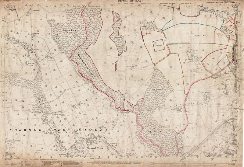
Old Ordnance Survey Maps of Yorkshire - Sheet 231. 3. 1908 (b)
Norwood Green & Low Moor (southwest) in 1908 (b)
Scale 1:2500 or 25 inches to the mile : Original map size 40 x 29 inches [102 x 74 cms]
Please refer to the modern map shown below.
Switching views from 'Sat' to 'Map' may be useful.
TO CONFIRM A LOCATION ON THIS MAP, PLEASE EMAIL US YOUR QUERY BEFORE PURCHASE.Thefields around Royds Hall have their names pencilled-in, together with either a P (pasture), A (arable) or M (meadow).Plost in the Green Market area have their tenants named - Paul Normington, Isaac Brear, John Ires, Ada Rushworth, Hezikiah Hirst (who had hen runs on his plot), Charles Henry Harrison who also had hen runs, and John Alfred Harrison.
There are also a couple of notes marking old shafts around Hedge Nook.
PURCHASE
300dpi scan of the map seen below
complete with any additions as described above
£5.99

LARGE PRINTED MAP
Near full-size colour print of the map below.
33 x 24 inches on 120gsm coated paper.
Posted rolled in a tube.
£12.99
< Return to Menu >
Modern area from Google Maps
(to re-set, refresh the page)
[NOTE- approx. area only - please email if you need to confirm a location on the old map (above) before purchase]
View Larger Map