OLD TOWNS BOOKS & MAPS
Download Street View Maps of UK Towns
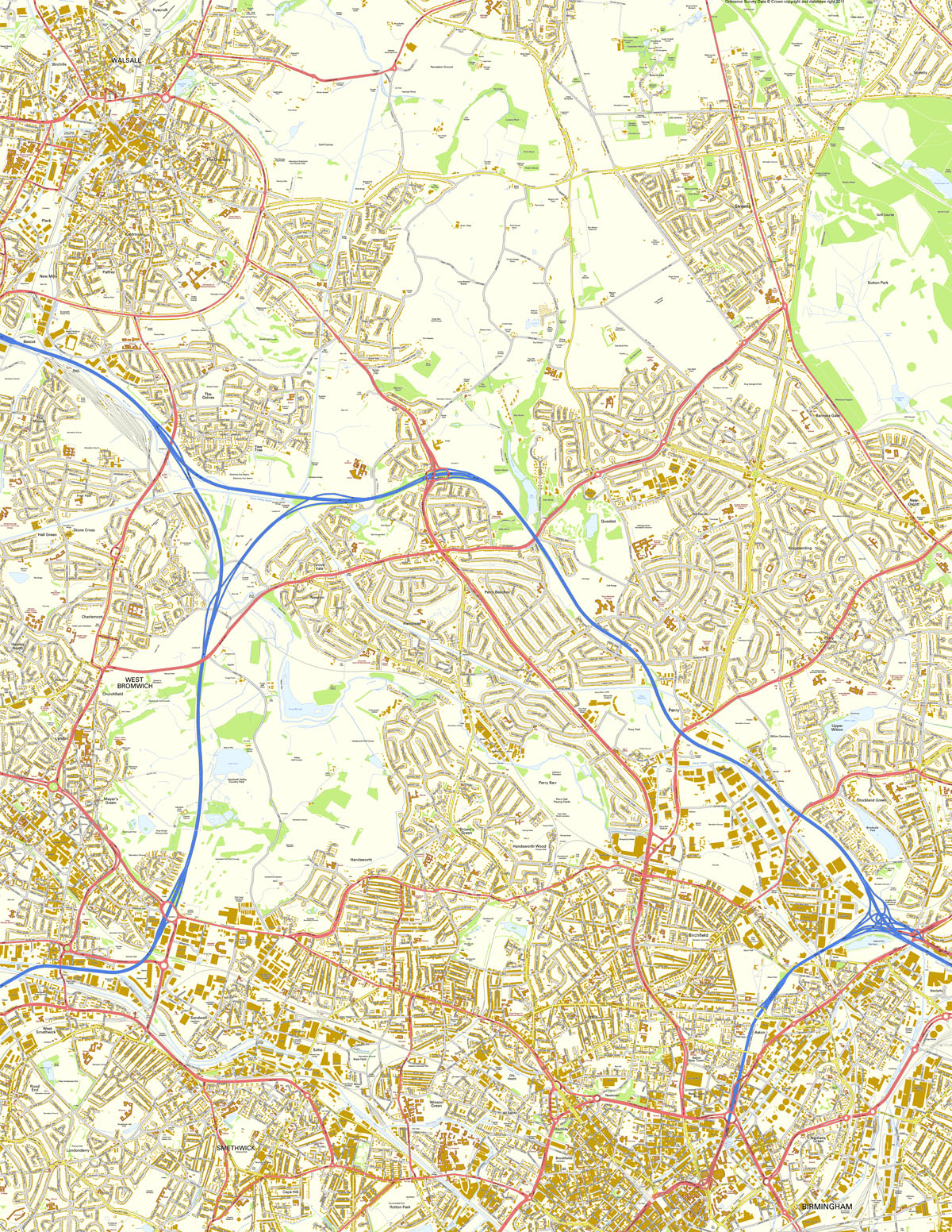
BIRMINGHAM (NORTHWEST)
SHOWING: WALSALL, Birchills, Ryecroft, The Chuckery, Streetly, Sutton Park, Caldmore, Palfrey, Pleck, New Mills, Bescot, The Woods, The Delves, Yew Tree, Banners Gate, New Oscott, Perry Common, Kingstanding, Queslett, Perry Beeches, Hamstead, Newton, Grove Vale, Charlemont, Stone Cross, Hall Green, Hateley Heath, WEST BROMWICH, Hall End, Churchfield, Lyndon, Mayer's Green, Perry Bar, Perry, Witton, Upper Witton, Stockland Green, Birchfield, Handsworth Wood, Brown's Green, Handsworth, West Smethwick, Rood End, Sandwell, Soho, Winson Green, Gib Heath, Lozells, Newtown, Aston New Town, New Town Row, Aston, Nechells, Vauxhall, Nechells Green, Hockley, Brookfields, All Saints, Rotton Park, Cape Hill, SMETHWICK, Londonderry
SIZE: 10,000 x 12,934 pixels (254 dpi) - Printed size 1.00 x 1.29 metres
FOR MORE DETAILS ABOUT THIS STYLE OF MAP, CLICK HERE
Contains Ordnance Survey Data © Crown copyright and database right 2011
SEE THUMBNAIL BELOW
DOWNLOAD PURCHASES ARE NOT REFUNDABLE
PDF Instant Download
16.2 MB view in Adobe Reader, fully printable £9.99
Print any part of the map using the flexible Print controls in Adobe Reader
JPEG Instant Download
35.7 MB to use in any graphics software, fully printable £12.99
Print the map in whole or any part, add your own content (text, graphics) etc